



Saipan’s WWII History: The Island’s Most Important Historic Sites
Saipan feels like a quiet tropical getaway, but step onto the northern coast and the island’s WWII scars become impossible to ignore. I spent three days driving from the hotel in Chalan Kanoa to each of the battle‑scarred sites, and the stories that unfolded along the road still echo in my mind.
If you’re planning a history‑focused trip, bring a good pair of walking shoes, a refillable water bottle, and a small notebook for the details you’ll want to remember later. Most sites are free, but a few have modest parking fees or guided‑tour charges that are worth budgeting for.
Banzai Cliff, The View That Witnessed Tragedy

The first stop on my itinerary was Banzai Cliff, a sheer limestone drop that looks out over the Pacific. A short walk down a steep, unpaved path brings you to a wooden railing that was installed after the war to keep visitors from getting too close.
At the top, the ocean stretches to the horizon, and you can almost hear the distant rumble of artillery that once echoed here. The site is marked by a simple plaque in English and Japanese, and a few tourists linger to read the translated inscription.
Parking is free, but the lot fills up quickly in the late morning, so I arrived around 9 a.m. to avoid the crowd. The walk down to the cliff edge takes about five minutes, and the descent is steep enough that I had to use my walking stick.
There’s no restroom on site, so I made a quick stop at a nearby convenience store before heading back up. The store sells cold drinks for 1 USD, which felt like a small luxury under the hot sun.
When the wind picks up, the sound of waves crashing against the rocks is deafening, and it’s easy to imagine why so many soldiers chose to jump. The experience is sobering, and I left feeling a mix of awe and melancholy.
- Free parking (lot fills by 10 a.m. in high season)
- Arrive early to avoid crowds and heat
- Bring a walking stick for the steep descent
- No restroom; use nearby convenience store (open 7 a.m.-10 p.m.)
Suicide Cliff, The Final Stand
Only a few kilometers north of Banzai Cliff lies Suicide Cliff, another dramatic drop that became the last desperate defensive point for Japanese troops. The name is a direct translation of the Japanese term “Jisei‑ga‑hō,” and the site holds a small shrine dedicated to those who fell.
I drove there after lunch, stopping at a roadside stall that sold fresh papaya for 2 USD. The stall owner warned me that the road can get bumpy after rain, so I checked the weather forecast before heading out.
The parking area is a gravel lot that charges 2 USD per car, and it’s shaded by a lone palm tree that offers a brief respite from the sun. From the lot, a short, well‑marked trail leads to a viewpoint with a metal railing.
At the edge, the view is less about the ocean and more about the sheer vertical wall that rises over 100 feet. A plaque explains that over 4,000 Japanese soldiers and civilians died here during the final days of the battle.
There’s a small memorial garden behind the viewpoint where families leave flowers and incense. I noticed a few tourists lighting incense sticks; the shop sells a pack of three for 0.80 USD.
- Parking fee: 2 USD per car (shaded lot)
- Trail is short (5 min) but steep; wear sturdy shoes
- Incense sticks sold nearby for 0.80 USD per pack
- Best visited late afternoon for softer light
American Memorial Park, A Tribute to the Pacific Campaign
The American Memorial Park sits on the western side of the island, near the former airfield where U.S. forces landed on June 15, 1944. The park covers 120 acres and includes a museum, a visitor center, and a large open field used for ceremonies.
I arrived around 2 p.m., just as the park’s staff were preparing for the daily guided tour. The tour costs 5 USD per person and lasts about 45 minutes, covering everything from the landing beaches to the post‑war reconstruction.
The museum houses a collection of original helmets, rifles, and a battered Jeep that still has its original paint chipped away. I was surprised to see a handwritten letter from a soldier dated July 1944, displayed in a glass case.
Parking is free, but the lot can be busy on weekends, so I parked near the entrance and walked the short distance to the visitor center. There’s a small café that sells coffee for 2 USD and a slice of pineapple cake for 1.50 USD.
After the tour, I spent some quiet time at the memorial wall, where names of fallen soldiers are etched in granite. The wind carried the distant sound of a bugle, a reminder that the site is still used for official commemorations.
- Guided tour: 5 USD per person (45 min, starts hourly)
- Free parking (lot fills by 3 p.m. on weekends)
- Café coffee 2 USD; pineapple cake 1.50 USD
- Museum open 8 a.m.-5 p.m.; last entry at 4:30 p.m.
Landing Beaches, Beaches 1, 2, and 3
The three main landing beaches are marked with simple signs and are scattered along the western shoreline. Each beach has a small marker explaining which U.S. division landed there and the date of the assault.
Beach 1, also called “Red Beach,” is closest to the old airfield and has a shallow reef that made the landing difficult. I waded through the water with my shoes on to get a feel for the conditions troops faced.
Beach 2, known as “Blue Beach,” is wider and has a stretch of sand that is now a popular spot for locals to fish. A rusted tank hull sits half‑buried near the shoreline, a stark reminder of the battle’s intensity.
Beach 3, the southernmost landing site, is the least crowded and offers a clear view of the old Japanese fortifications that were captured on June 20. I found a small souvenir shop nearby selling miniature tank models for 3 USD.
All three beaches have free public parking, but the lots are small; I paid a 1 USD fee at Beach 2’s lot because the lot was full. The fee is collected by a local vendor who also rents snorkeling gear for 7 USD per day.
- Free signage at each beach explains landing details
- Beach 1: shallow reef, wade with shoes for safety
- Beach 2: rusted tank hull; souvenir shop sells mini tanks 3 USD
- Beach 3: best for quiet reflection; nearby fort ruins
- Parking fee at Beach 2: 1 USD; snorkeling gear rental 7 USD per day
C‑1 and C‑2 Camps, The Prisoner of War Camps
The former C‑1 and C‑2 prisoner‑of‑war camps sit on the island’s eastern side, tucked behind a cluster of coconut trees. The sites are not as polished as the memorial park, but they offer a raw glimpse into the harsh conditions endured by captured soldiers.
I rented a scooter for the day (10 USD) and rode the winding road that leads to the camps. The road is narrow and has several sharp turns, so I kept my speed low and enjoyed the occasional glimpse of the sea.
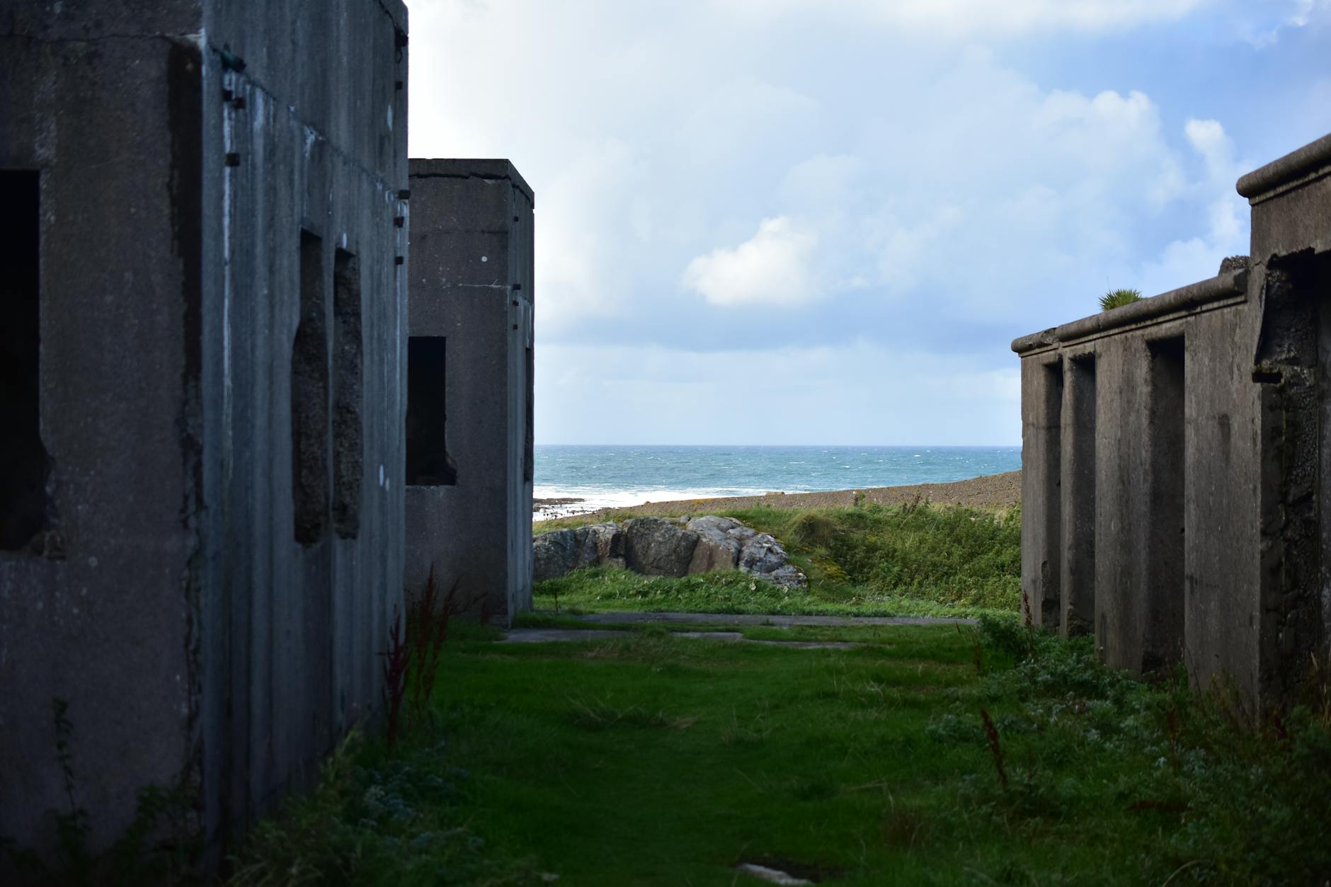
At C‑1, the remains of a wooden barracks are still standing, though most of the roof has collapsed. A small information board, written in both English and Japanese, details the daily routine of the POWs.
C‑2 is a bit farther inland and consists of a series of concrete foundations that once held metal bunks. I found a rusted metal bucket that still had a faint imprint of a soldier’s initials.
Both sites are free to enter, but there is a modest donation box at each where visitors can contribute to the preservation fund; I dropped in 2 USD each. The camps are quiet, and you’ll often hear only the distant call of a tropical bird.
- Scooter rental: 10 USD per day (helmet included)
- C‑1: wooden barracks remnants; info board bilingual
- C‑2: concrete foundations; original metal bucket still visible
- Donations suggested: 2 USD per site
- Road is narrow with sharp turns; drive slowly