Samoa

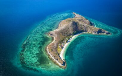
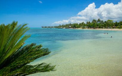
Samoa is located halfway between Hawaii and New Zealand. Its natural wonders include waterfalls, mountains, volcanoes and miles of secluded beaches.

Capital and major centres
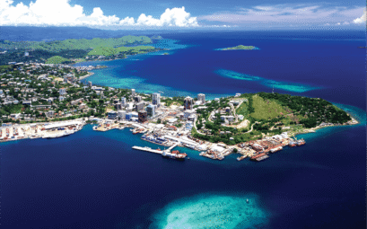
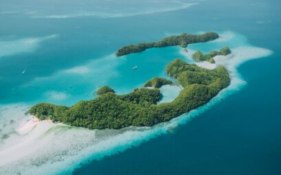
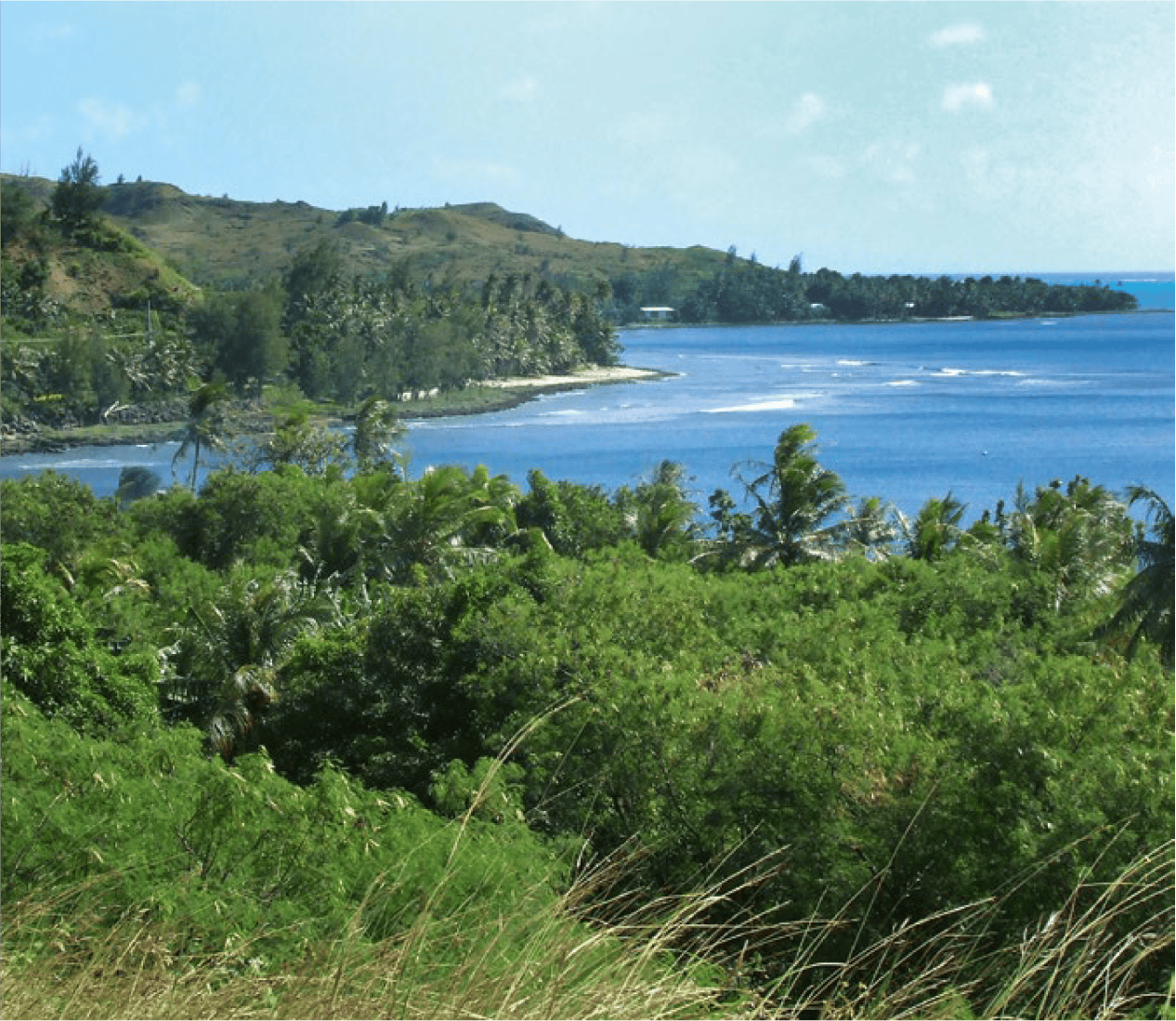
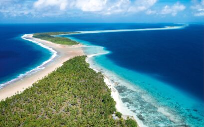
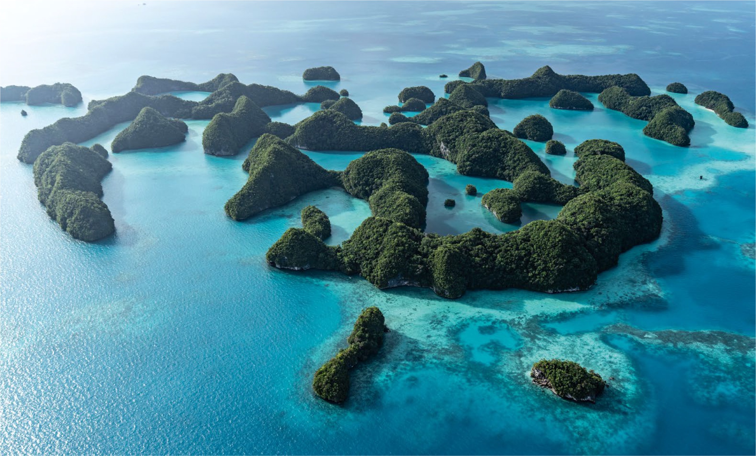
Samoa is made up of ten islands, of which Savai’i is the largest. Its neighbour, Upolu is the most populated and the location of the capital, Apia, along with the international airport, the seat of government and the centre of commerce. Savai’i is dotted with secluded beaches and crowned at the centre by the 1858 metre Mt Silisili.

The main entry point into Samoa is Faleolo International Airport, 35 kilometres from Apia. Currency exchanges are open for all international flight arrivals and departures. Airport shuttles are provided to the major hotels and can be booked prior to arrival or organised after clearing Customs.

Taxis are also available but it’s recommended to confirm the price to your destination with the driver before you depart.
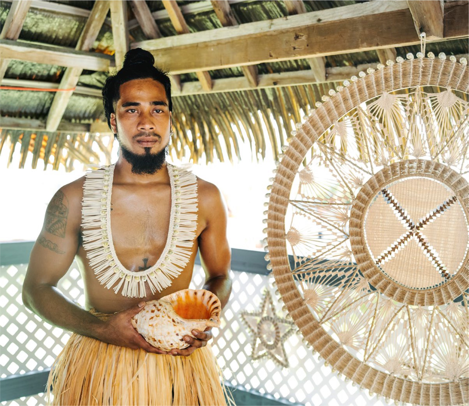
The people
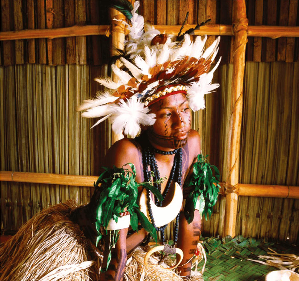
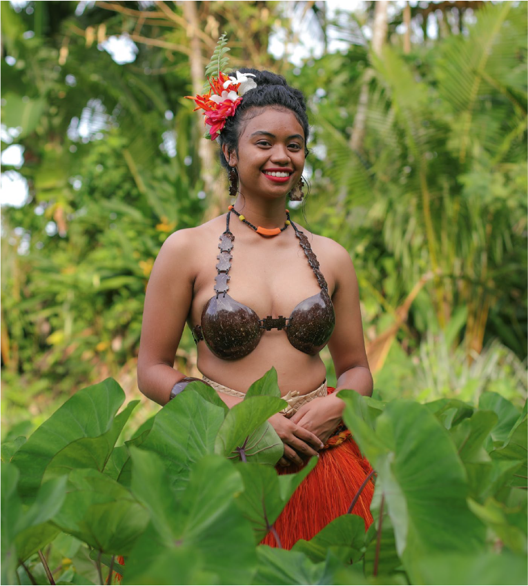
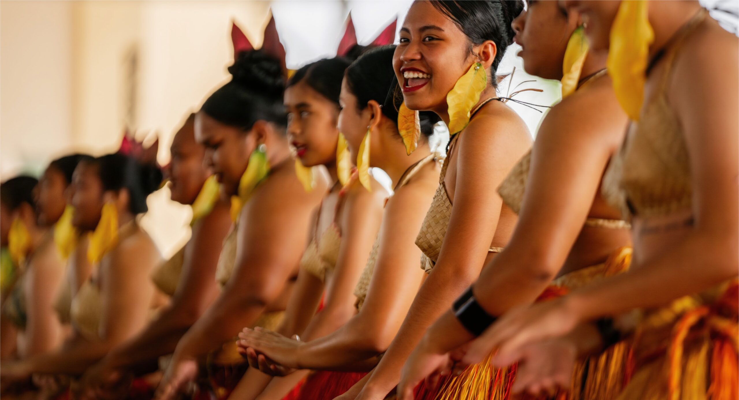
Samoans are the largest group of full-blooded Polynesians in the world and have retained much of their ancient culture. Their practice of fa’a Samoa, (the Samoan Way), is a living culture that centres around the family unit and love and respect for all.

Their tradition of tattooing is an intricate art and has been a cultural right of passage for generations. Many Samoans proudly display complex symbolic designs from the lower chest to the knees.
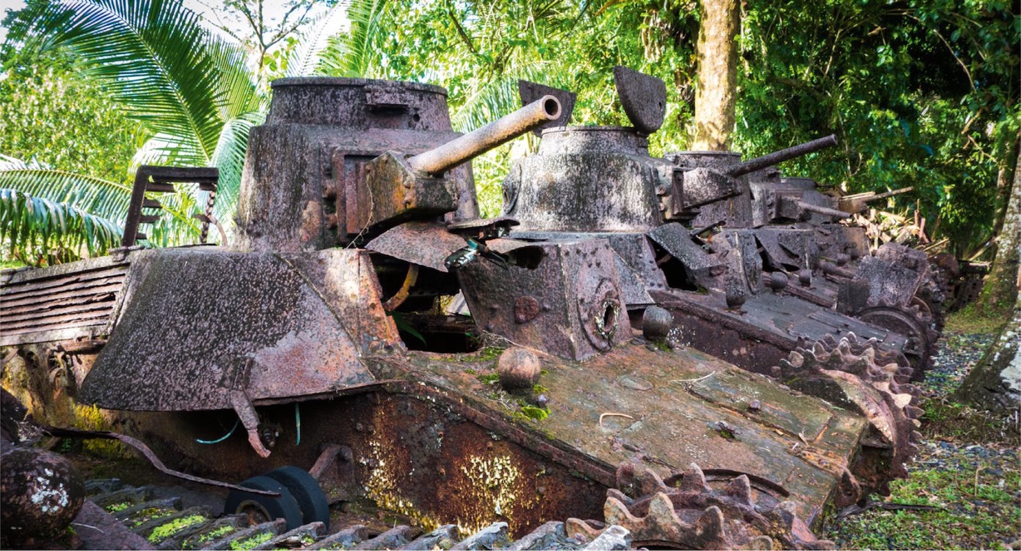
History
These islands were first settled about 1000 BC and are accepted as the heart of the Polynesian culture. In 1768, Louis de Bougainville sighted Samoa and named them ‘The Navigator Islands’ because of the many Samoans sailing small canoes far from the sight of land.

During the 18th century, vast plantations producing copra and cotton were developed for export and Apia became a major commercial centre in the South Pacific. Samoa was annexed by Germany from 1899 to 1914 and then by New Zealand from 1914 until 1962, when Western Samoa finally gained self government. The ‘Western’ was dropped from its official name in 1997.

Although Samoan is the native language, English is widely spoken.
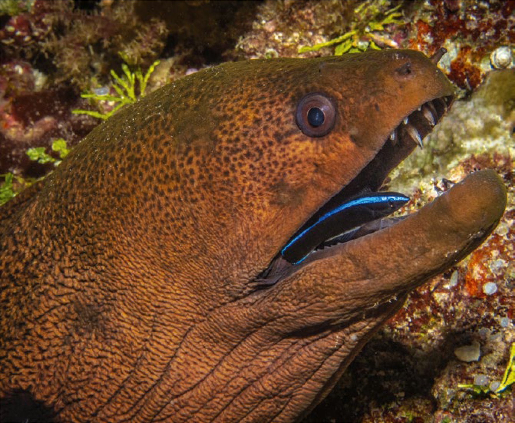
Nature
Both islands are rich in fauna and flora. Savai’i has lush tropical rainforests, housing many exotic bird species. Conservation organisations provide funding to ensure the rainforests at Tafua and Falealupo on Savai’i are protected and maintained.

Samoa’s climate is tropical all year round, with two distinct seasons, the dry season running from May to October and the wet season from November to April. The average daily temperature is 29ºC and the ocean is warm enough to swim all year round.

The sights
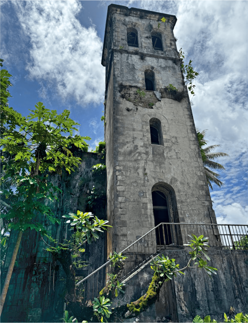
The Scottish writer, Robert Louis Stevenson brought his family to live at Upolu in 1890 and built a large home in the foothills above Apia, where he spent his last years.

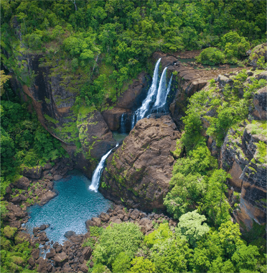
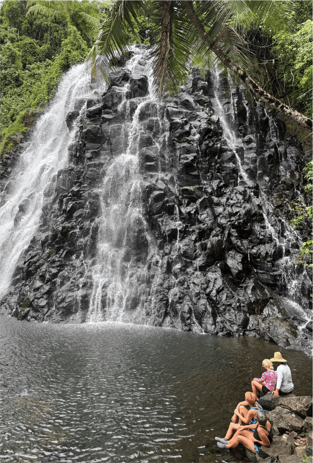
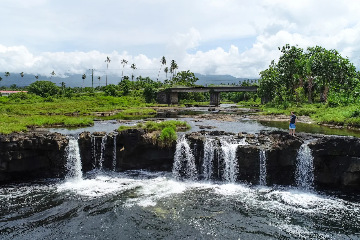
Stevenson was known as ‘Tusitala’ (the storyteller) and he is buried on the crest of Mt Vaea. His home is now a magnificent museum and offers tours rich in detail of Stevenson’s life by local guides. Other places to visit include the Tiavi Falls, also known as Papapapaitai, the O Le Pupu Pu’e National Park and Papaseea with its smooth rocks which are fun to slide down and swim in the pools beneath.

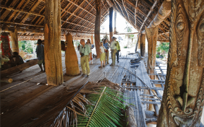
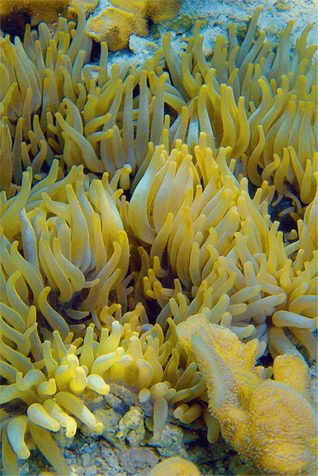
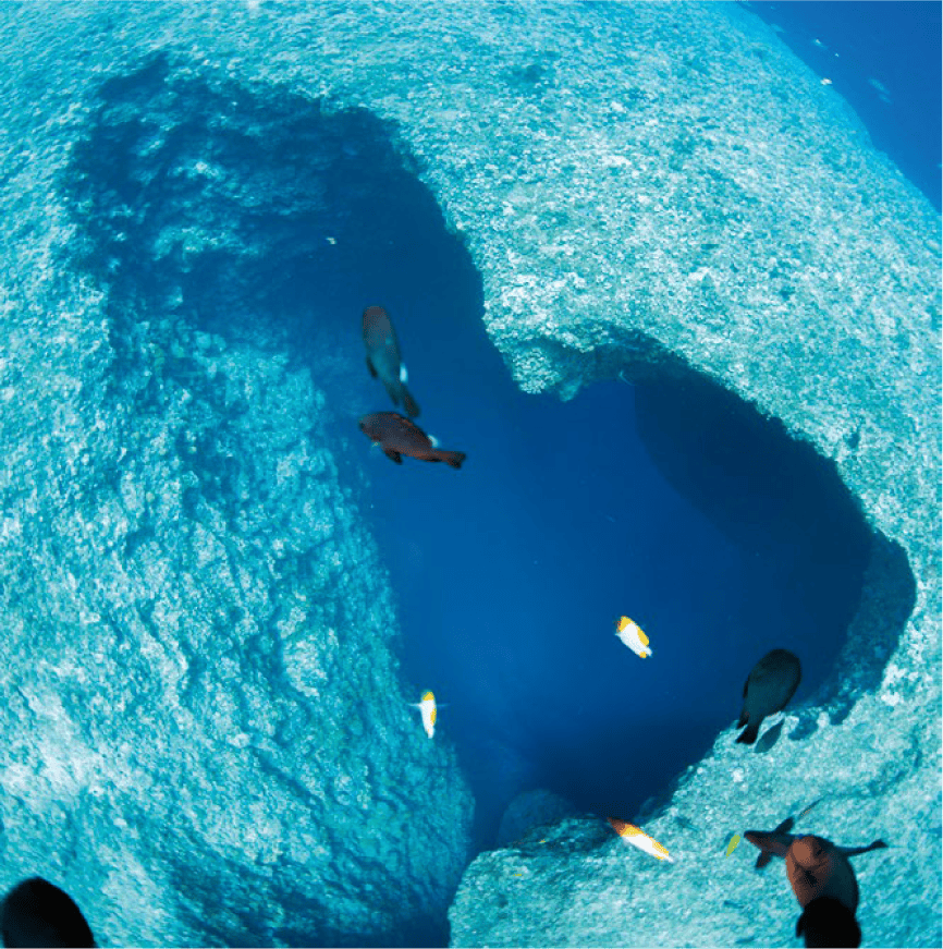
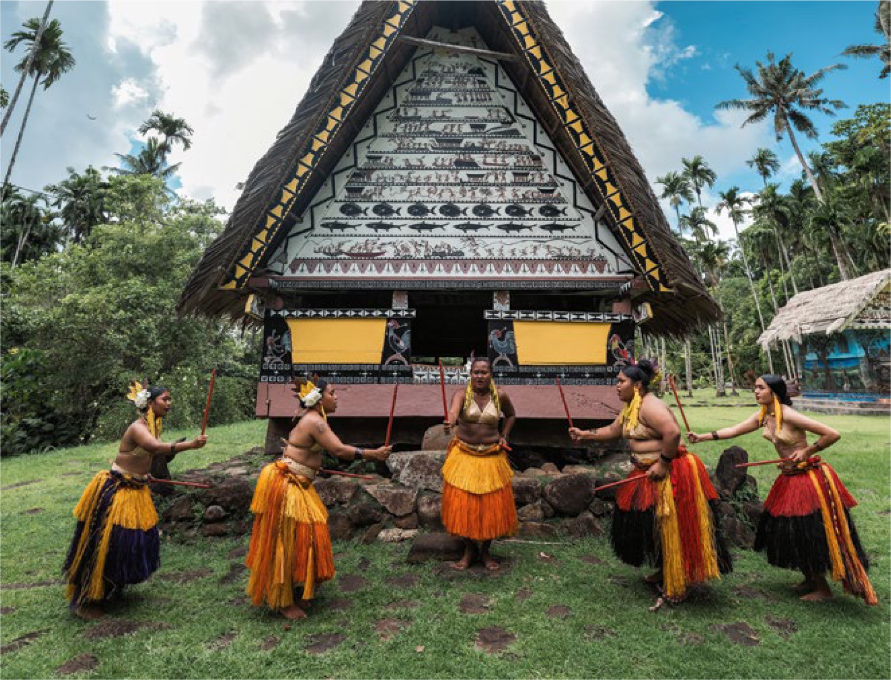
Also worth seeing is Piula Cave pool in the grounds of the Methodist Theological College, and not forgetting the popular To Sua Trench located at the south east coast of Upolu Island. No matter which direction you go, you will regularly pass through nu’u or villages with their distinctive and lovingly decorated churches, large meeting houses and open fales or homes encircling the malae or village green.

Food and entertainment
The main hotels have restaurants and Samoan feasts or fiafia nights are held at the larger resorts on a weekly basis. Entertainment includes traditional Polynesian singing and dancing. There are also several clubs and cocktail bars in Apia.

Where to stay
Accommodation ranges from international standard to traditional fales. Villagers will negotiate private rates as well as home accommodation for budget travellers.

Activities
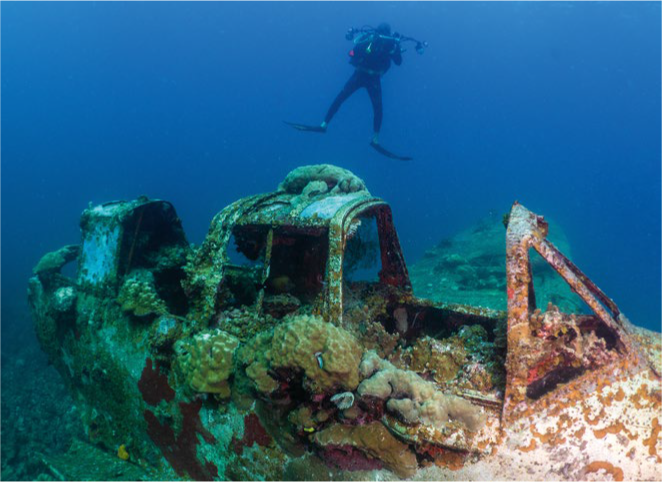
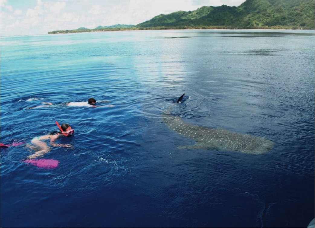
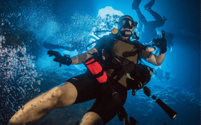
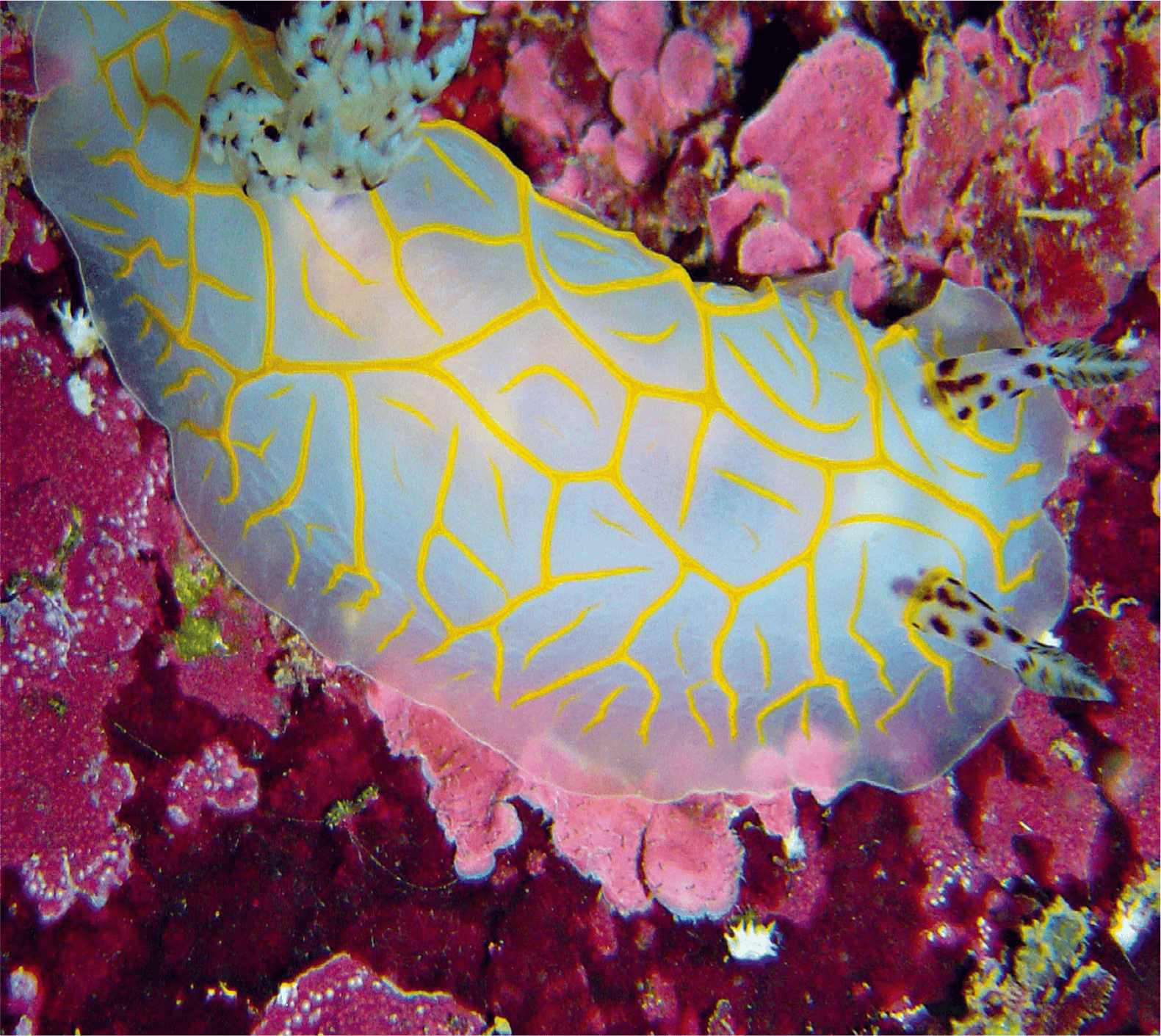
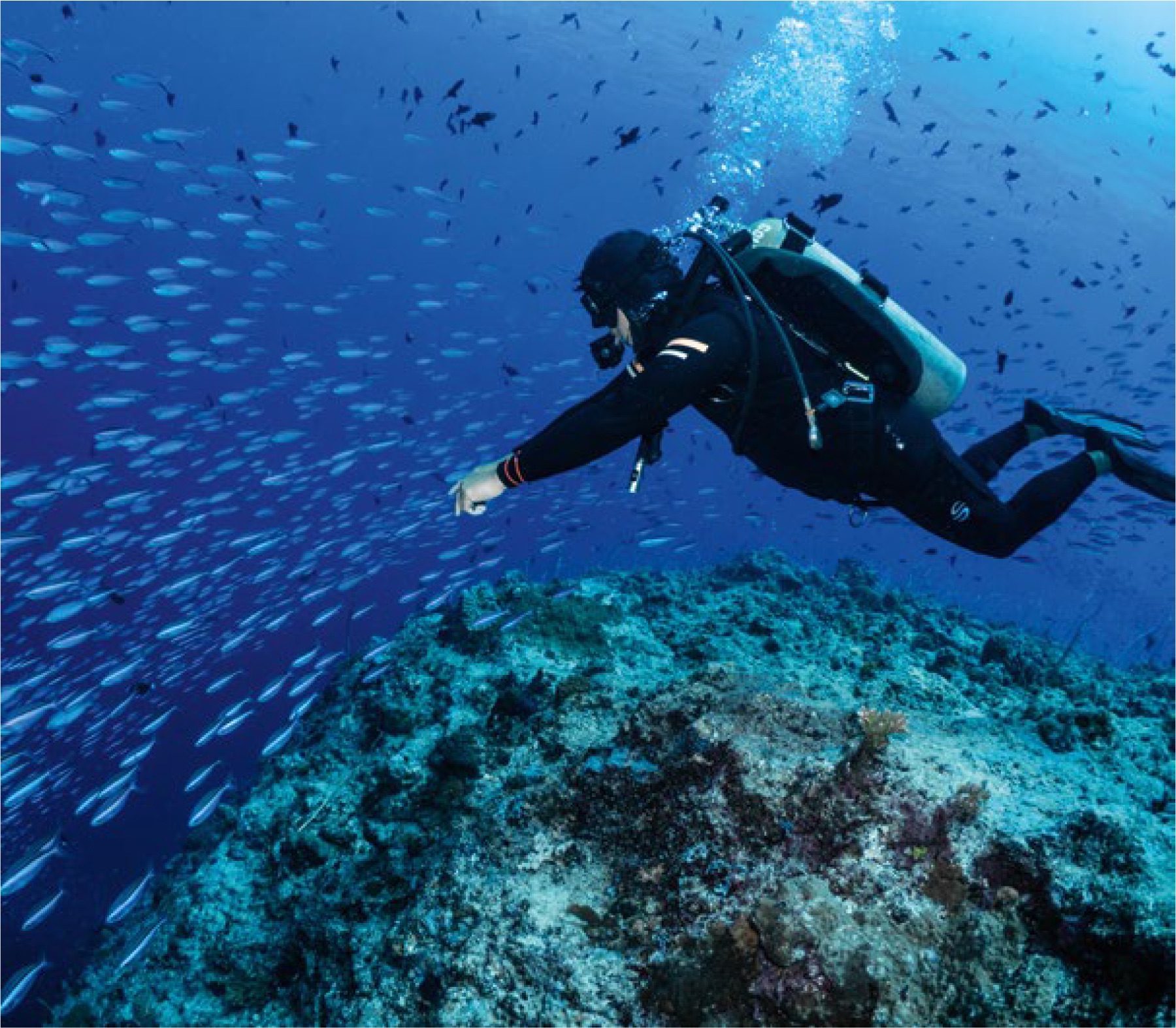
Samoa has long been a favourite destination for surfers. Local sporting facilities include golf, tennis, squash, lawn bowls, rugby, soccer and Samoan cricket. There are also numerous marine activities including swimming, snorkelling and diving.

Shopping guide
A variety of goods made by Samoan families for their personal use are also sold to visitors. Siapo (tapa) cloth is made from mulberry bark, painted with native dyes and is made into mats, hats and baskets.

Fugalei Street in Apia, is home to the local fruit markets and just nearby is the flea market, which sells a variety of souvenirs such as kava bowls, are hand carved from native hardwood and lava lavas (the Samoan sarong). Shell jewellery and Samoan music are also available.

ANZ and Westpac are the international banks in Samoa. Both have branches at the international airport, in Apia and at Salelologa on Savai’i. Shopping hours are from 8am to noon and 1.30pm to 5pm weekdays and 8am to 12.30pm on Saturday.

Getting around
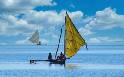
The two islands have more than 1800 kilometres of road between them. In Apia, there are taxis and rental cars available. Samoana Rental has a wide range of vehicles and offers a free pick up and delivery service to Apia hotels. For those who want to go island hopping, the only way to travel between islands now is by ferry which takes around two hours.

The Highlands & The Sepik

The Sepik is an immense expanse of jungle and coastal terrain, containing one of the world’s greatest river systems, running 1126 kilometres from its origins high in the mountains to the sea.

The people along the river depend heavily on it for transportation, water and food. Their cultural links with the Sepik River are symbolised in many of their ancient and spiritual rituals, such as the manhood initiation. This requires painful carving of flesh on the backs of young men with razor blades. Patterns are that of a crocodile lying on the banks of the river.

The history of the Sepik region reflects the influence over the years of the missionaries, traders, labour recruiters and administrators.

Here river and crocodiles, man and nature have learned to live in mutual respect. Parts of the Highlands remain untouched just as they were when first ‘discovered’ in 1933.

The people are hardy and village life depends on subsistence farming. Visitors will be fascinated by the bright ochre colours, intricate face paints, wooden carvings, and spirit masks. Dancing is proud and exuberant at traditional sing-sings, accompanied by drum beats, chanting and string bands.

The Eastern Highlands Province is a one-hour flight north from Port Moresby or half an hour from Lae or Mt Hagen. Once there, you are surrounded by steep, rugged mountains covered in dense rainforest graduating to sub-alpine vegetation.

The valleys are blanketed in grass and the panoramic views contain every imaginable shade of green. Altitude varies from 600 metres in the south to Mt Michael’s 2750 metre summit. Goroka, the largest town and capital, lies at 1600 metres above sea level.

The Sepik River has no actual river delta and stains the sea brown for up to 50 kilometres. It is said that islanders off the coast can draw fresh water straight from the sea. The Sepik River is navigable for almost its entire length and winding its way through the land it resembles a huge, brown, coiling serpent. The force of the river tears great chunks of mud and vegetation out of the river banks and at times these drift downstream and appear as floating islands. You can cruise the middle Sepik aboard the quaint Sepik Spirit, a slow house-boat. In addition, Kalibobo Spirit is available primarily for charter, though it doesn’t have a schedule. On special occasions the ship operates expeditionary cruises to the Sepik and the PNG Islands.

West Sepik or Sandaun Province is near the Indonesian border of West Papua. It is home to the Upper Sepik people who move around in long, narrow dugout canoes. There is now a scenic highway route connecting Vanimo to Wutung in the Sandaun Province – called the Vanimo-Jayapura Highway. Pope Francis visited Vanimo in 2024, and many Catholic West Papuan Indonesians crossed the border to see him.

The centres are Vanimo and Amanab and villages around here have strong religious beliefs centred on deities that are believed to hold supernatural powers that are vital for survival in this remote and dense countryside. Vanimo is also a well-known surfing spot.

East Sepik is the middle and lower region from Angoram to Wewak town. There are a number of large rubber and cocoa plantations along the river flats.

Wewak is an attractive palm-fringed town, which felt the might of Japanese troops who ‘discovered’ its isolation and its hidden ports around Kairiuru Island.

Many war memories remain around the plantations and a Japanese gun still points from the eastern end of the island.


Port Moresby

Port Moresby is home to around 756,000 people, with a melting pot of local and international cultures.

The city consists of a complex traditional society formed by historical bonds between the traditional land owners, the coastal Motuans and the inland Koitabu. Port Moresby fluctuates from the hustle of commercialisation to the serenity of a country town. Downtown at the waterside is the nostalgic Port Moresby.

At the entrance of Fairfax Harbour are Lolorua and Daugo (Fishermen’s) Islands, favourite picnic areas for sailors. Beautiful views from Paga Point overlook Ela Beach and Koki Point. Juxtaposed to the metropolis in the south-west is the partly stilt-based Hanuabada Village.

Burnt down after WWII, the big village was rebuilt by the Australian Administration. Despite cosmetic changes, the character of the village is still there and is renowned for elaborate ceremonies. Koki market on the waterfront is a favourite for trade in fresh seafood and has a colourful fruit and vegetable market. Be sure to visit Unity Mall, a collection of locally owned businesses selling local products, arts and crafts, a perfect place for local souvenir shopping. As well as renowned shopping centres like the Vision City Mega Mall and the Rangeview Plaza selling both local and international brands.

Make time to visit the local craft markets that take place every month in Port Moresby:

  • POM City Markets: Night Markets at the Harbourside Precinct and the Vision City SME Fair. (See: https://www.facebook.com/pomcitymarkets/)
  • Moresby Arts Theatre: Craft markets held every first Saturday of the month.

The National Parliament, a symbol of modern architecture, contrasts with the dignity of traditional design at The National Museum and Art Gallery. The first permanent display of local artefacts was established here in 1978 and is well worth a visit. Located on the slopes of Independence Hill at Waigani, it’s open weekdays and Sunday afternoons.

In February or March join in the celebrations of the Hiri Moale Festival to commemorate the historical trade between villagers around the Gulf Province and the Motuans and Koitabuans of Central Province. The festival features canoe races, processions, choirs, string bands, sing-sings and the Hiri Queen contest. The Sogeri Plateau (46 kilometres from Port Moresby) is where the Kokoda Trail became the centre of war between Japanese and Allied Troops during WWII.

Varirata National Park is a spectacular mountain region, with views over Port Moresby and the coastline. If you get up early enough, you can catch the mist blanketing the ranges.

Westbound from Port Moresby is the Hiritano Highway, connecting the city with Bereina, home of the Kairuku and Mekeo people. The Mekeos are renowned for their strong chieftain system and grand traditional costumes.

Islands

Papua New Guinea

Papua New Guinea: A Journey Through Uncharted Diversity in 2024

Papua New Guinea (PNG), a land of striking contrasts and unspoiled beauty, continues to captivate travelers seeking authentic experiences in 2024. As one of the world’s most culturally diverse nations, with over 800 indigenous languages and countless traditional societies, PNG offers an unparalleled adventure into both nature and culture. While tourism infrastructure is steadily improving, the industry remains relatively young, providing visitors with the unique opportunity to explore untouched landscapes and engage with vibrant traditions away from crowded tourist trails.

Nestled on the eastern half of the island of New Guinea—the world’s second-largest island—PNG’s geography is as diverse as its people. The country sits precariously on the Pacific Ring of Fire, resulting in a dramatic landscape shaped by volcanic activity and tectonic movements. Towering mountain peaks cloaked in misty rainforests give way to fertile valleys, while pristine beaches and coral-fringed islands dot the coastline. Beneath the surface, the underwater world mirrors this topography with majestic coral gardens, teeming marine life, and World War II shipwrecks waiting to be explored.


Major Cities and Regions

Port Moresby

The capital city serves as the primary gateway to PNG. Located on the southern coast, it offers a blend of modern amenities and traditional culture. Visitors can explore the National Museum and Art Gallery, wander through vibrant markets, or relax at Ela Beach.

  • Contact Information:
    • National Museum and Art Gallery
      • Address: Independence Drive, Waigani, Port Moresby
      • Phone: +675 325 2451
      • Email: info@museumpng.gov.pg
      • Website: www.museumpng.gov.pg

Lae

The country’s second-largest city and an important industrial hub. Situated at the mouth of the Markham River, Lae is the starting point for journeys into the highlands and the Huon Peninsula.

Madang

Renowned for its picturesque harbor adorned with lush tropical vegetation. Diving enthusiasts flock here to explore its coral reefs and the 34 sunken ships from World War II.

  • Contact Information:
    • Madang Visitors and Cultural Bureau
      • Phone: +675 422 3302
      • Email: madangvcb@datec.net.pg

Goroka and Mount Hagen

Centers of cultural significance in the highlands. These towns host annual cultural shows, such as the Goroka Show and the Mount Hagen Cultural Show.

  • Contact Information:
    • Goroka Show Society
      • Email: gorokashow@gmail.com
    • Mount Hagen Cultural Show Committee
      • Phone: +675 542 1180

Sepik Region

Towns like Wewak and Vanimo are famed for intricate art and carvings. The mighty Sepik River supports a way of life deeply connected to its rhythms.


The People

PNG’s people are predominantly Melanesian, but the nation’s cultural tapestry includes Micronesian, Polynesian, Chinese, and European influences. The sheer number of languages spoken makes it one of the most linguistically diverse countries on the planet. Tok Pisin (Melanesian Pidgin) and Hiri Motu are widely used lingua francas, while English serves as the official language in government and education.


Nature and Wildlife

Designated as a megadiverse country, PNG boasts an incredible array of flora and fauna. Its rainforests are home to unique species found nowhere else. Wildlife enthusiasts can encounter approximately 242 species of mammals and 762 bird species, including the spectacular Birds of Paradise.


Activities and Adventures

  • Trekking: The famous Kokoda Track is a challenging trail steeped in World War II history.
  • Diving and Snorkeling: Explore coral reefs and historical wrecks in Madang, Kimbe Bay, and Kavieng.
    • Contact Information:
      • Walindi Plantation Resort (Kimbe Bay)
      • Lissenung Island Resort (Kavieng)
  • Cultural Festivals: Attend sing-sings and cultural shows in Goroka or Mount Hagen.
  • Bird Watching: Guided tours to spot rare and endemic species.
    • Contact Information:

Getting Around

Due to the challenging terrain, air travel is the most efficient way to move between regions. Domestic flights connect major towns and remote areas.

  • Airlines:
    • Air Niugini (National Airline)
    • PNG Air

Food and Entertainment

PNG’s culinary scene is a blend of traditional and international influences. Staples include taro, yams, sweet potatoes, sago, and fresh seafood.

  • Dining Recommendations:
    • Port Moresby:
      • Asia Aromas
        • Phone: +675 321 4780
        • Email: info@asiaaromas.com.pg
      • Fusion Bistro
        • Phone: +675 302 8588
  • Accommodation:
    • Airways Hotel
      • Address: Jacksons Parade, Port Moresby
      • Phone: +675 324 5200
      • Email: reservations@airways.com.pg
      • Website: www.airways.com.pg
    • Grand Papua Hotel
      • Address: Mary Street, Port Moresby
      • Phone: +675 304 0000
      • Email: reservations@grandpapuahotel.com.pg
      • Website: www.grandpapuahotel.com.pg

Shopping Guide

Shopping for souvenirs is an opportunity to support local artisans:

  • Craft Markets:
    • Ela Beach Craft Market (Port Moresby)
      • Held: Last Saturday of every month
      • Contact: Via PNG Tourism Promotion Authority
  • Jais Aben Resort (Madang): Offers local crafts and artwork.

Climate and Best Time to Visit

PNG experiences a tropical climate:

  • Coastal Areas: Warm and humid, temperatures from 23°C to 32°C (73°F to 90°F).
  • Highlands: Cooler temperatures between 14°C to 28°C (57°F to 82°F), with chilly nights.
  • Best Time to Visit: During the dry season from May to October.

Important Contacts and Information

Emergency Services

  • General Emergency (Police, Fire, Ambulance): Dial 111

Papua New Guinea Tourism Promotion Authority

  • Address: Level 5, Pacific MMI Building, Champion Parade, Port Moresby
  • Phone: +675 320 0211
  • Email: info@papuanewguinea.travel
  • Website: www.papuanewguinea.travel

Major Hospitals

  • Port Moresby General Hospital
    • Address: Hospital Road, Korobosea, Port Moresby
    • Phone: +675 324 8200
  • Pacific International Hospital
    • Address: Three Mile, Port Moresby
    • Phone: +675 323 4400
    • Email: info@pihpng.com
    • Website: www.pihpng.com

Embassies and Consulates in Papua New Guinea

  • Australian High Commission
    • Address: Godwit Road, Waigani, Port Moresby
    • Phone: +675 7090 0100
    • Email: public-affairs-portmoresby@dfat.gov.au
  • United States Embassy
    • Address: Douglas Street, Port Moresby
    • Phone: +675 321 1455
    • Email: ConsularPortMoresby@state.gov
  • British High Commission
    • Address: Level 7, Pacific Place, Port Moresby
    • Phone: +675 303 7600
    • Email: ukinpng@fcdo.gov.uk

Airlines and Airports

  • Air Niugini
    • Reservations: +675 327 3400
    • Email: callcentre@airniugini.com.pg
  • PNG Air
    • Reservations: +675 722 221
    • Email: reservations@pngair.com.pg
  • Jacksons International Airport (Port Moresby)
    • Information Desk: +675 324 4705

Important Local Contacts

  • Police Headquarters
    • Phone: +675 324 4200
  • Tourist Police (Port Moresby)
    • Phone: +675 320 2633
  • International SOS Port Moresby Clinic
    • Address: Level 1, IPA Haus, Munidubu Street, Port Moresby
    • Phone: +675 699 3016
    • Email: png.clinic@internationalsos.com
    • Website: www.internationalsos.com

Travel Tips

  • Visas: Check entry requirements before traveling. Some nationalities can obtain a visa on arrival, while others need to apply in advance. Contact the Papua New Guinea Immigration and Citizenship Authority:
    • Phone: +675 327 6100
    • Email: info@immigration.gov.pg
    • Website: www.ica.gov.pg
  • Health Precautions: Consult a healthcare provider for vaccinations and advice on malaria prophylaxis. Carry necessary medications and practice standard health precautions.
  • Respect Local Customs: Always ask permission before photographing people or sacred sites. Modest dress is appreciated, especially in rural areas.
  • Safety: Be aware of your surroundings, especially in urban areas. Use reputable tour operators and guides.
  • Currency: The official currency is the Kina (PGK), divided into 100 toea. Major towns have banking facilities and ATMs. Credit cards are accepted in hotels, restaurants, and larger shops in urban areas.

Conclusion

In 2024, Papua New Guinea stands as a frontier for travelers yearning for authentic experiences. Its untouched landscapes, rich cultural heritage, and warm hospitality offer a journey unlike any other. Whether trekking through misty mountains, diving into vibrant coral reefs, or sharing in the rhythms of a village sing-sing, PNG invites you to be part of its ongoing story—a story of diversity, resilience, and endless discovery.

For more information and assistance in planning your trip, contact:

  • Papua New Guinea Tourism Promotion Authority

Please note that while every effort has been made to ensure the accuracy of this information, contact details may change. It is advisable to verify details with the respective organizations before making travel arrangements.

Palau

The Serengeti of the Sea, and Beyond

From a bird’s-eye view, Palau’s Rock Islands present a mesmerizing spectacle, resembling a constellation of emerald-hued formations dispersed across a serene turquoise lagoon. The Rock Islands Southern Lagoon was inscribed onto the UNESCO World Heritage list in 2012 for its outstanding value. Among the 1,199 distinguished World Heritage Sites worldwide, only 39 are recognized as mixed heritage sites, and Palau proudly claims its spot on that prestigious list.

Upon arrival in the Republic of Palau, visitors are greeted by lush vegetation and the warmth of the local culture. It is home to 18,000 people, who speak both Palauan and English. Rechad er Belau, or Palauans, are the indigenous people of Belau, the traditional name of Palau. The archipelago encompasses a diverse range of ecosystems, from volcanic savannahs to verdant rainforests and vibrant coral reefs, showcasing the full splendor of nature’s beauty.

The island’s marine biodiversity rivals that of any other location on Earth, commonly referred to as the “underwater Serengeti” and named one of the seven underwater wonders of the world. It’s like a bustling metropolis under the sea, with every nook and cranny teeming with diverse organisms. What sets Palau apart as a diving destination is its commitment to sustainable tourism practices. The government of Palau, in collaboration with local communities and conservation organizations, has implemented measures to protect its marine resources while offering exceptional diving experiences.

Its dedication to preserving the environment is deeply ingrained in its historical narrative and forms an integral part of its identity. Sharks thrive in waters that, in 2009, became the world’s first shark sanctuary, setting an example that has been followed by many other island destinations.

Its idyllic beauty is a stark counterpoint to the brutal battles that unfolded on its shores during World War II. Today, Palau offers visitors a unique opportunity to explore not only its natural wonders but also the haunting remnants of its past.

World War II relics randomly dot the underwater seascape with an almost perfect sense of dispersion; displaying haunting wrecks of World War II Japanese seaplanes and shipwrecks that render the islands a dream for wreck diving aficionados. The irrepressible synergy between all the wonderful elements found in Palau’s diving sites gives way to many of the finest diving venues.

Beyond diving, Palau offers an array of natural wonders and cultural experiences. Palau comprises diverse terrains – including lush jungles, hidden caves, pristine beaches, and rock islands. Moreover, it is rich in biodiversity. Approximately 75% of Palau is covered in native forest and mangroves that are home to various endemic plants and faunas. Over 100 plant species and birds have been recorded, of which at least one third of these species are endemic to the island. Hidden away in the lush tropical jungle and forests, lie obscured waterfalls that preside magically over their respective natural domain.

Palau stands out not just for its breathtaking natural scenery but also for its people. The warmth, welcoming hospitality, and sincere smiles contribute significantly to Palau’s beauty.

A democratic country that still abides by its culture and traditional leadership, Palauan villages were, and still are, traditionally organised around matrilineal clans. Men and women have defined roles. A council of chiefs governs the villages, while a parallel council of women holds an advisory role in the control of land, money and the selection of chiefs. The Palauan people adhere to a spirit of respect, known in their native language as omengull, which illuminates various aspects of their way of life. This character extends to the treatment of all individuals and entities within their community. Palauan culture, a testament to its resilience, thrives even in the face of modernization, high-speed internet, and urban development. Such cultural richness is a rare gem in today’s world.


Yap

Part of the Federated States of Micronesia, Yap is situated in the Western Caroline Islands, between Guam and Palau.

Yap is surrounded by a vast stretch of around 130 outer islands and coral atolls scattered across the western Pacific. Most of these outer islands are coral atolls and are sparsely populated by a people that differ from those from the Yap Main Island both in culture and language.

Rolling hills, red-clay valleys, thick jungle vegetation, mangrove coastlines, and fringing reefs define the landscape, creating a setting that feels both remote and deeply rooted in nature.

Colonia, the capital, is the island’s small urban center while, beyond it, village life continues much as it has for generations. Most land and beaches are privately owned, and visitors are welcomed warmly when they move respectfully – asking permission, observing local customs, and engaging with the community at its own pace.

Yap is renowned both for its living traditions and lively underwater environment. On land, village life remains rooted in practices observed daily, most visibly in the iconic stone money – large limestone discs that line village paths and symbolize value, relationships, and history, with ownership still shifting through local agreement rather than size alone, and traditional meeting grounds and men’s houses continuing as active community centers.

At the same time, Yap has gained international recognition as a premier diving destination in the Pacific. Clear, warm, waters support a resident population of manta rays that be reliably seen at several shallow cleaning stations year- round, with courtship “manta season” particularly active from roughly December through April, and many individuals identified and tracked by researchers.

Divers also enjoy a wide range of underwater experiences, from abundant coral walls, caverns, and macro life to frequent encounters with reef sharks, turtles, eagle rays, and deep outer reef sites often in uncrowded conditions.

Yap’s reefs are considered among the healthier in the Pacific, with visibility frequently exceeding 30 m (100 ft) and miles of largely unexplored reef awaiting discovery.

Culture here is not staged, it is lived. Visitors may encounter village dances, hear ancient chants carried across open dance grounds, or see traditional dress worn during ceremonies: brightly colored loincloths for men and woven hibiscus or grass skirts for women.

Four indigenous languages are spoken across Yap State: Yapese, Ulithian, Woleaian, and Satawalese, alongside English which is widely used.

Only a small number of travelers visit Yap each year, and this is part of its appeal. Those who come seeking authenticity, cultural depth, and meaningful connection often leave with a lasting impression of
an island that values its land, traditions, and way of life above all else.

The official currency is the US dollar. Credit cards are accepted at most hotels, restaurants, and main shops, though carrying some cash is recommended. Yap is not a place to rush – it is a destination to experience slowly, respectfully, and with curiosity.


Pohnpei

This is the largest island in the Eastern Caroline Group and the capital of the FSM.

Pohnpei fits the typical South Sea island image with lush vegetation, abundant rainfall and tumbling waterfalls, and is renowned for its tropical jungles, mist-covered mountains, and some of the healthiest mangrove swamps and exotic flora in the Pacific. Situated in the northwestern Pacific, it is 880 metres high, 21 kilometres wide and shaped somewhat like a circular tent. Also known as the garden island of Micronesia, its boldest landmarks are Sokehs Rock and Nan Madol. Nan Madol is an ancient stone city built on the tidal flats of the eastern part of Pohnpei.

There are approximately 100 artificial islets constructed of basalt logs of various sizes up to 70 tons each, making Nan Madol the largest and one of the most mysterious archaeological sites in the Pacific.

The first European to visit the island group was Spaniard Diego de Rocha in 1526. The islands were originally called the New Philippines until 1696 when they were renamed the Caroline Islands. Occupied by Spain, Germany, Japan and the USA, Pohnpei experienced 100 years of foreign rule because it proved to be an ideal supply stop for the Pacific expeditions. Pohnpeian is the native language, however, both English and Pohnpeian are used in business.

Archaeologists and engineers are attempting to discover more about the race which constructed the island city of Nan Madol. The stone fortress was built on a reef south-east of Temwen Island by the rulers of Pohnpei around 500 AD until it was taken over by Isokelekel, the warrior who installed the present traditional system in the 1520s.

Nan Madol is reached by boat from the main town of Kolonia about 45 minutes away. It’s a full day boat tour which includes a visit to the spectacular Keprohi Waterfall and snorkelling in the lagoon.

A 20-minute ride out of Kolonia takes you to the Nanpil River where further along are the spectacular Liduduhniap Twin Waterfalls, complete with thatched huts where you can picnic in a jungle setting. A day trip to privately owned Black Coral Island in the lagoon is the perfect way to safely snorkel the reef and, for a family day, visit Langer island with its simple cottages where visitors can stay overnight.

In Kolonia you can see the Spanish Wall, built in 1889 as a boundary for Fort Alphonso XII. Nearby is the Catholic Mission Bell Tower, all that remains of the old German church torn down by the Japanese during WWII.

Also take a stroll into the Polynesian village and watch the craftsmen whittle ornaments from locally grown ivory seed. Most tours operate from Kolonia, and many of the waterfalls and areas of historical and ecological importance can only be reached by guided tour.

Accommodation is in both traditional Pohnpeian thatched roofed bungalows with garden showers, and Western-style hotels. There is no public transport, only taxis and rental cars, but most hotels offer shuttle services. Tourist facilities are clean and the service is friendly.

A visit to the Pohnpeian cultural centres is a must for anyone wishing to experience traditional Pohnpeian life. Each centre has a distinctive program and performances include traditional dancing, singing, music, ceremonial sakau making, handicraft arts, and food preparation. The village shops specialise in handicrafts and popular items include carvings of sharks, fish, dolphins and canoes.

When it comes to relaxing, try sakau, the numbing local drink which is used in ceremonies and also sold in bars.


Kosrae

The State of Kosrae is one of four states in the Federated States of Micronesia and, as well as the island of Kosrae, consists of several islands and islets, the most significant being Lelu Island.

Roughly triangular in shape, Kosrae covers an area of approximately 110 square kilometres.

The most eastern of the Caroline Islands, Kosrae has a population of less than 6000 people and is located north of the equator between Guam and the islands of Hawaii. The coral reefs that surround the island are kept in a pristine condition through an extensive mooring buoy system and the area is becoming a favourite destination for scuba divers from all around the world. The island’s interior is covered with deep vegetation and steep mountains that keep it largely undeveloped.

European contact with Kosrae in 1824 reported a highly stratified society that was typical of the surrounding islands at that time. Its cultural features included matrilineal lineage and clans with a feudal structure of nobles who controlled the land that was worked by commoners. The settlements consisted of small groups of relatives who shared a single cookhouse, usually with at least one earth oven.

The first missionary post was established in 1852 after American missionaries felt the need to protect the people of Kosrae from the large numbers of whalers and beachcombers who had made the island, which they considered a paradise, their home.

Even today religion plays an integral role in the culture of Kosrae. Sunday is considered a day of rest and most stores and shops are closed on that day.

In 1874, the slave trader William “Bully” Hayes was shipwrecked on Kosrae when his ship was stuck in Lelu harbour during a storm. During his stay of several months on the island, Bully terrorised the local people. He was finally arrested by Captain Dupuis aboard the HMS Rosario but managed to escape on a boat built of timber from the wrecked ship.

Traditional foods on the island include breadfruit, coconut, banana, taro, yam and sugarcane. Woodcarving, traditional canoe and cottage construction, fishing, farming and fine weaving using hibiscus, pandanus and coconut palms continue to be an integral way of life on the island.

The weather in Kosrae is warm and humid throughout the year with an average temperature of 25°C and rarely exceeding 32°C. It has two distinct seasons, dry and rainy and during the rainy season, November to April, be prepared for showers every day.

Casual and summer clothing is worn throughout the year although swimsuits and shorts are not acceptable in the villages. Be respectful cover your shoulders and knees, and don’t forget a hat, sunglasses and sunscreen.

Kosrae is a wonderful gem, yet to be discovered by most modern travellers. A visit guarantees the experience of a lifetime from the unhurried, friendly lifestyle and warm, island hospitality that are as unforgettable as the magical Micronesian sunsets.

Guam

Like an emerald glistening in a velvet blue jewel case, the green peaks of Guam emerge from the surrounding waters of the Western Pacific.

Guam is the largest and most southern island in the Mariana Islands archipelago in the northern area of the Pacific Ocean, covering 540-549 square kilometres and with a population of approximately 167,000 people.

Situated approximately 2494 kilometres south of Japan and 6115 kilometres west of Hawaii, Guam has pristine beaches, championship golf courses, world-class diving and snorkelling.

Visitors can experience a variety of cultural and historical sites, outdoor activities as well as recreational events.

As the largest and most developed island in Micronesia, Guam serves as a transportation and communications hub and is the gateway to Micronesia, a region of 2000 islands and atolls spread over five million square kilometres of the Pacific.

Guam is also America’s airline link to Asia with an average flight time of around three hours to most Asian cities.

The terrain of Guam is a startling contrast of limestone plateaus. The steep cliffs and narrow coastal shelves in the central and northern parts of the island are wonderful to observe.

Volcanic hills range up to 204 metres which is the height of Mount Lamlam that is the tallest mountain in the world from below sea level as a result of Guam’s proximity to the Mariana Trench.

Southern Guam features lush jungles and quiet seaside villages. The central area of the island has all the modern conveniences of suburban living, with restaurants, bars, shopping centres and international class resort hotels fronting Tumon and Agana Bays.

Guam’s earliest settlers were the Chamorros who make up about 37 percent of the island population today. They are thought to have travelled by canoe from South-East Asia to the Mariana Islands, where they lived isolated from the rest of the world for centuries.

The Chamorros flourished as an advanced fishing, horticultural, and hunting society and were skilled craftsmen who built unique houses and canoes well suited to this region of the world. They are also skilled in intricate weaving and detailed pottery making.

In 1521, Ferdinand Magellan, the explorer sponsored by the Spanish court, arrived on Guam and forged a link between Spain and the Chamorros.

The Spaniards’ influence lasted more than 300 years until the island became a US Territory in 1898 after the Spanish-American War. The Japanese briefly occupied the island until 1944 when it was liberated by American forces.

Today, even with modern suburban living, Guam still offers abundant natural beauty. The island is blessed by year-round balmy tropical weather and cooling trade winds. Stunning coral reefs and clear crystalline blue lagoons, teeming with colourful aquatic life ring Guam’s white sand coastline. Its verdant interior is lush jungle with hidden waterfalls, rivers and volcanic ridges.

Guam’s natural offerings have something for everyone above and below water. There is fishing, hiking, golf, kite and windsurfing, parasailing, scuba diving, snorkeling, jet-skiing, dolphin watching and cultural tours to name but a few.

SEA LIFE UP CLOSE

The Fish Eye Marine Park Underwater Observatory is the only facility of its kind in Micronesia. Through underwater windows, visitors can view the pristine beauty of Guam’s undersea world – its diverse coral formations as well as stunning tropical fish.

To get up even more close and personal to the sea life, take the eco-snorkeling tour and witness the impressive fish diversity in Piti Bay, Guam’s most well-known and visited marine preserve.

The snorkeling area is home to over 200 colourful species of fish. An easy walk on the sea bridge and down steps to the site ensures convenient access.

Seeing wild dolphins up close is another attraction. Guam is one of the special places in the Pacific that hosts a resident population of wild dolphins just offshore – visitors can view them from the comfort of a boat. The trip takes viewers along Guam’s beautiful coastline and when the pod is located, these playful marine mammals can be observed swimming at the bow and surfacing to play. Usually spinner dolphins appear – famous for their leaps, jumps, and spins out of the sea.

CULTURE & CUISINE

An island cultural show is also offered at The Observatory – performed by Fish Eye’s legendary Manahune dance group. While enjoying the show, indulge in a dinner buffet of delicious island cuisine including a variety of regional dishes, all enjoyed within the ambiance of the Garden Restaurant, surrounded by a lagoon, waterfall, and lush tropical plants.

HISTORY ON SHOW

Walk through Guam’s history by visiting the new permanent exhibit at the Senator Antonio M. Palomo Guam Museum and Chamorro Educational Facility in Hagåtña. The first of its kind on the island, this 6,200 square foot ($576m^2$) gallery, located on the second floor of the Guam Museum, features interactive, state-of-the-art technology and the most complete display of the history and culture of Guam in the Chamorro language to date.

The exhibit is designed to educate and entertain audiences of varying ages, backgrounds, and languages. Over 300 curated artifacts, thousands of images, multiple audios, and short films have been carefully pieced together across seven galleries to guide visitors through the historical, Chamorro narrative of Guam. Descriptive panels are written in English and Chamorro and are accompanied by QR codes that translate the text into Japanese, Mandarin Chinese, and Korean.

Galleries feature local artwork in various mediums, and depict notable eras from Guam’s history, culture, and society. Some of Guam’s oldest artifacts, including slingstones, pottery sherds, and pounding stones are displayed.

There are also displays illustrating the ancient Chamorro way of life with reproductions of the sakman (seafaring outrigger canoe), guma higai (pole-and-thatch hut) and guma latte (latte house).

Also portrayed is the arrival of the Spanish then the Americans, detailing the impact of modernism and the Western influence on Chamorro culture and society. Then the devastation of World War II is covered, starting with the Japanese Occupation and finishing with the American Liberation of the island. Interestingly, a display can be viewed of the effects of Sergeant Shoichi Yokoi – a Japanese soldier who hid in the jungle for 28 years after the war.

History and geography have given Guam a vibrant cosmopolitan population. The charm and warmth of the people originates from the eclectic blend of Spanish, indigenous Chamorro, Asian and Western cultures. The mix of East, West and Pacific traditions and cultures is evident and is infused in the arts and crafts, language, and especially the food of this island nation.

Guam is truly an undiscovered Pacific gem and deserves to be shortlisted as one of your next holiday destinations.


Micronesia

The islands of Micronesia are spread over a great distance, and each has its own culture and topographical personality. Set in sparkling waters which change shades of colour from deep blue through to sea green, each one is ringed by coral reefs.

Your first glimpse of these ‘pearls’ of the Pacific are of specks of land surrounded by necklaces of white waves. Each island is covered in lush tropical vegetation, but the real action is underwater where there is some of the richest and most varied marine life to be found anywhere in the world.

Capital and major centres
The islands vary in size and political status. The most well known is Guam, which is an American territory and serves as a gateway to the other island groups.

The islands of Pohnpei, Chuuk (Truk), Kosrae and Yap elected to join a federal government known as the Federated States of Micronesia with headquarters in Pohnpei. Palau and the Marshall Islands voted to remain independent and have established autonomous governments. Saipan, Rota and Tinian became the Commonwealth of the Northern Mariana Islands (commonly referred to as The Marianas or Northern Marianas) with Saipan the capital.

The people
The whole of Micronesia has fewer than 500,000 people. The region was settled about 2000 to 3000 years ago by an ancient seafaring race from areas in South-East Asia who migrated into, and successively colonised, the islands. English is widely spoken in addition to a number of indigenous languages, including Chamorro, Palauan, Yapese, Chuukese, Pohnpeian, Kosraean and Marshallese.

Nature
The islands of Micronesia are naturally diverse and include high volcanic islands, such as Pohnpei and Kosrae, raised coral islands such as Guam and Saipan, and coral atolls such as the Marshall Islands.

The inhabited areas vary from villages without cars or electricity, to the sophisticated resort areas of Guam and Saipan.

The underwater wildlife is particularly diverse, with the islands of Micronesia offering some of the most pristine and biodiverse underwater environments, which make scuba diving here excellent. Birds and plants abound on all of Micronesia’s islands.

The sights
Geologically, culturally and naturally diverse, the islands of Micronesia offer a wide range of natural and man-made attractions to suit every taste.

These differ from pristine underwater environments and lush island landscapes to sprawling resort areas with shopping and nightlife.

Where to stay
Each island differs in accommodation. The more developed islands such as Guam, Saipan and Palau have international hotels. There are some hotels on Rota while in the Marshall Islands, guest accommodation on some of the outer islands is in traditional thatched huts with few amenities.

Food and entertainment
The islands that are best equipped for tourism offer world-class seafood restaurants. In Guam, Palau and Saipan enjoy a variety of cuisine including American, Japanese, Korean, Chinese, Filipino, Mexican and Chamorro.

In Pohnpei try the local drink, sakau. In Chuuk sample Japanese and local cooking while in Rota indulge in the best of the traditional Chamorro cooking. In the Marshall Islands, American, Western-style cooking and Chinese cuisine go hand in hand with Marshallese specialties.

Activities
Comprising approximately 2000 islands and atolls, Micronesia caters for all levels of diving. Here’s a taste of what you can expect to find at the various destinations. Guam has an exceptional underwater world. The water is crystal clear, with 60 metres visibility commonplace, and you can expect to see coral gardens teeming with fish life, a unique blue hole and caverns. There are several wrecks of historical importance here including a Japanese Zero.

Also, the remains of a Spanish galleon, the world’s largest side paddle-wheeler, and a 230-metre passenger liner can be found layered on top of each other. You can also trace the remains of both world wars at the double wreck of the Cormoran, a WWI German Gunboat, and the Toka’s Maru, a Japanese freighter from WWII.

Saipan is famed for its beaches and some of the fiercest fighting between the Americans and the Japanese. As a result there are an estimated 18 sunken Japanese ships and many others as yet undiscovered. The majority of the wreck diving here is in Tanapag Harbour in depths of 12-18 metres with visibility up to 18 metres. The harbour has a ship believed to be the Shoan Maru, a B-29 Bomber, a Japanese seaplane, sub chaser, landing craft and a Zero fighter. An interesting snorkelling site is provided by two American tanks in two-and-a-half metres of water off Saipan World Resort.

The most adventurous site is the Grotto which starts at the base of 200 stairs. After submerging 18 metres down the cavern, you then swim through the tunnel to the outside wall of the island where visibility averages 30 metres.

Palau is known as one of the seven underwater wonders of the world, not surprising when you can stand atop a reef edge in knee-deep water and see it drop away to 320 metres vertically. It is believed that there are more than 50 WWII shipwrecks sunk in the lagoon. For a truly unique experience, how about diving in a land locked lagoon with 100,000 non-stinging jellyfish. Dive sites offer stalactite-filled caves, giant undersea tunnels and gorgonia fans that stand up to three metres tall.

Chuuk is renowned as having the best shipwreck diving in the world because of what is today known as the Ghost Fleet of Truk Lagoon. It consists of 50-60 ships and Japanese planes that were sent to the bottom after two days and a night of continuous strafing and bombing. The water temperature has served as a great incubator and the ships are now excellent artificial reefs, home to a variety of spectacular marine life. Underwater photography is a must here with the prolific coral growths that line the wrecks. The diving is year-round with visibility on the wrecks varying from 15-30 metres, and average depths between 12-40 metres.

Pohnpei is a maze of coral passes or channels leading from the outside sea into the inner lagoon offering great diving and superb coral formations, including deep gorgonia fans that can grow up to six metres in height. The shallow water is also the place to see barracuda, mantas and several varieties of curious reef sharks.

Yap is known as the island of manta rays because you can see mantas here consistently. A new find is the manta ray cleaning station where the mantas queue up to have parasites removed from them by small wrasses. These rays have a wing span of three to six metres and weigh in at approximately 460 kilograms.

Popular dives in Yap are Mill Channel, Manta Ray Pass and Goofnuw Channel. Mandarin fish are also becoming a diving attraction. When the sun goes down, these colourful little fish come out and stare at you.

Kosrae has consistently good diving conditions due to the triangular shape of the island. The great attraction here is the clear, clean water and live coral that encircles the island. August is usually the best month when visibility is up to 65 metres. Kosrae has a large population of turtles and during the mating season in December, their numbers escalate. Another great attraction is provided by the 150 dolphins that reside outside the reef.

Marshall Islands is Micronesia’s atoll diving destination. Made up of 29 coral atolls, diving in the Marshalls can be enjoyed either within the lagoons or in the open ocean. Dive sites include lagoon pinnacles, walls, channels, reef points, and vast areas of virgin, unexplored reef.

The Marshalls are also home to an abundance of WWII ship and plane wrecks concentrated in the lagoons of Bikini, Kwajalein, Jaluit, Mili, Wotje, Maloelap and Majuro Atolls. Dive excursions to seldom visited outer atolls can easily be arranged with local operators and shark sightings are guaranteed.

Shopping guide
Jade, coral, ivory, gold and handmade silks, plus handicrafts such as trays, baskets, hats, headbands and purses are popular purchases. The islanders are known for their weaving of pandanus leaves and for their traditional stick charts which fishermen have used for centuries for navigation.

Climate
Tropical with little seasonal change. Average temperature on all the islands is 30ËšC.

Clothing
Casual clothing is recommended. Swim wear is acceptable near beaches and pools, but not usually permitted in public areas.

Currency
US currency is used throughout Micronesia. Outside of Guam and Saipan, the use of credit cards is very limited, although major hotels on all islands take them. Tips are accepted.